Find High-Probability Water
— Before You Leave the Dock
ABFI Offshore is built for anglers making high-cost offshore decisions. It shows you where productive water is forming, where not to run, and why a zone is worth the commitment.
Three critical questions, answered before you leave the dock:
Because one good offshore decision pays for the system.
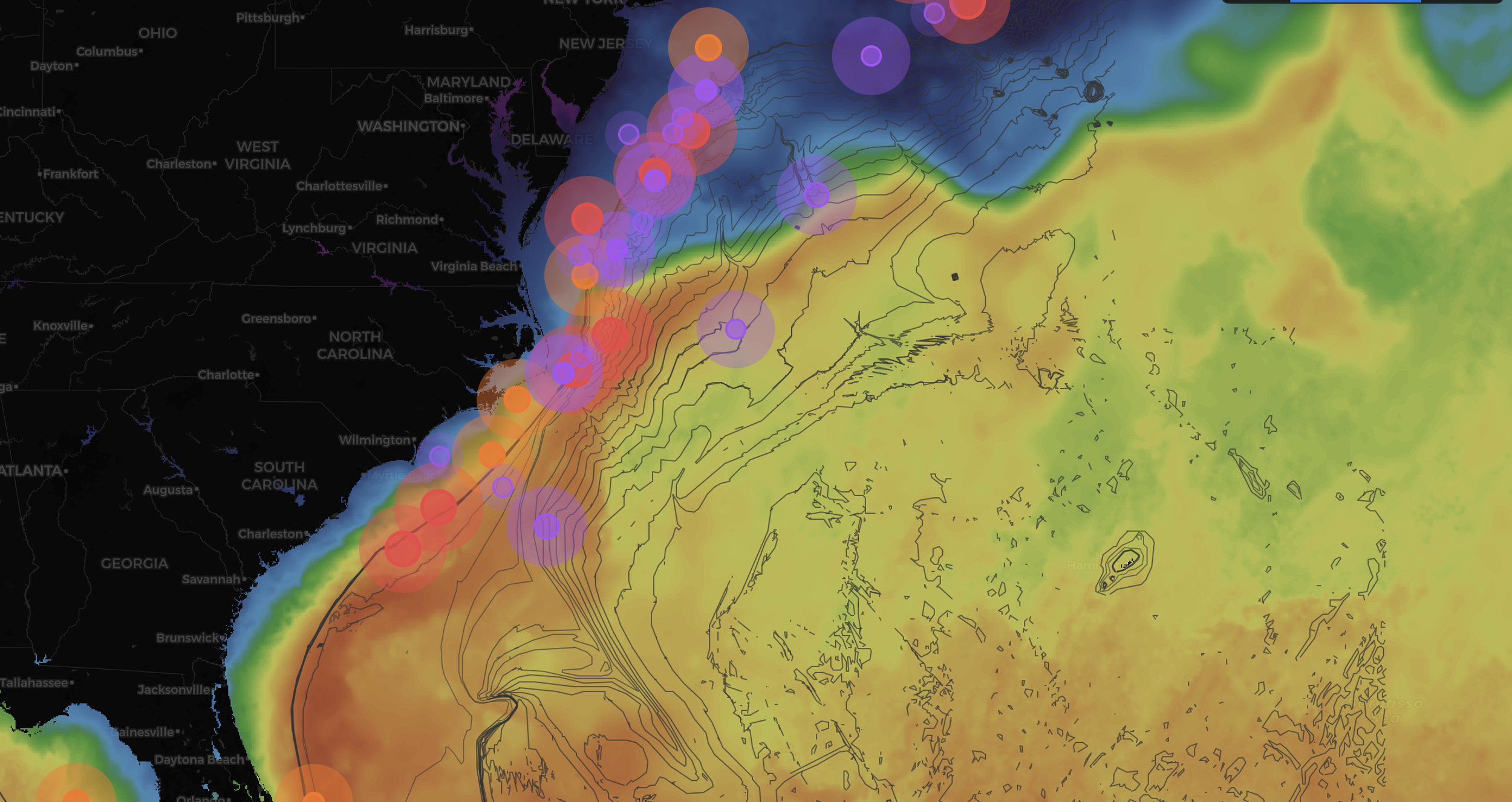
You can see the blue water is here and all the water is hot 80 degrees or hotter in most areas, so now what? That's where our app is useful — we can see where commercial boats are fishing, other members are fishing...— Jeff, ABFI Founder
Choose Your Access
Full Access to a
Decision System
ABFI Offshore gives you full access to a decision system built for high-cost offshore runs — not guesswork.
Full ABFI Offshore access for season-long planning and confident offshore decision-making.
One good offshore decision pays for the system.
Unlock Offshore Access12-month commitment
Full ABFI Offshore access with the flexibility of monthly payments. Same system, spread across the year.
Total annual cost: $1,788
Unlock Offshore Access
How Offshore Anglers Use ABFI
— Before the Trip
ABFI Offshore is used before trips to evaluate whether offshore conditions are worth the run. It reads large-scale movement, compression, and boundaries days in advance — so you can make informed decisions before burning fuel.
From Raw Satellite Data to
Confident Offshore Decisions
ABFI Offshore turns live satellite data into a focused offshore picture. Instead of raw feeds and unfiltered imagery, you get a clear read on where conditions are forming, shifting, and compressing — so you can decide with confidence.
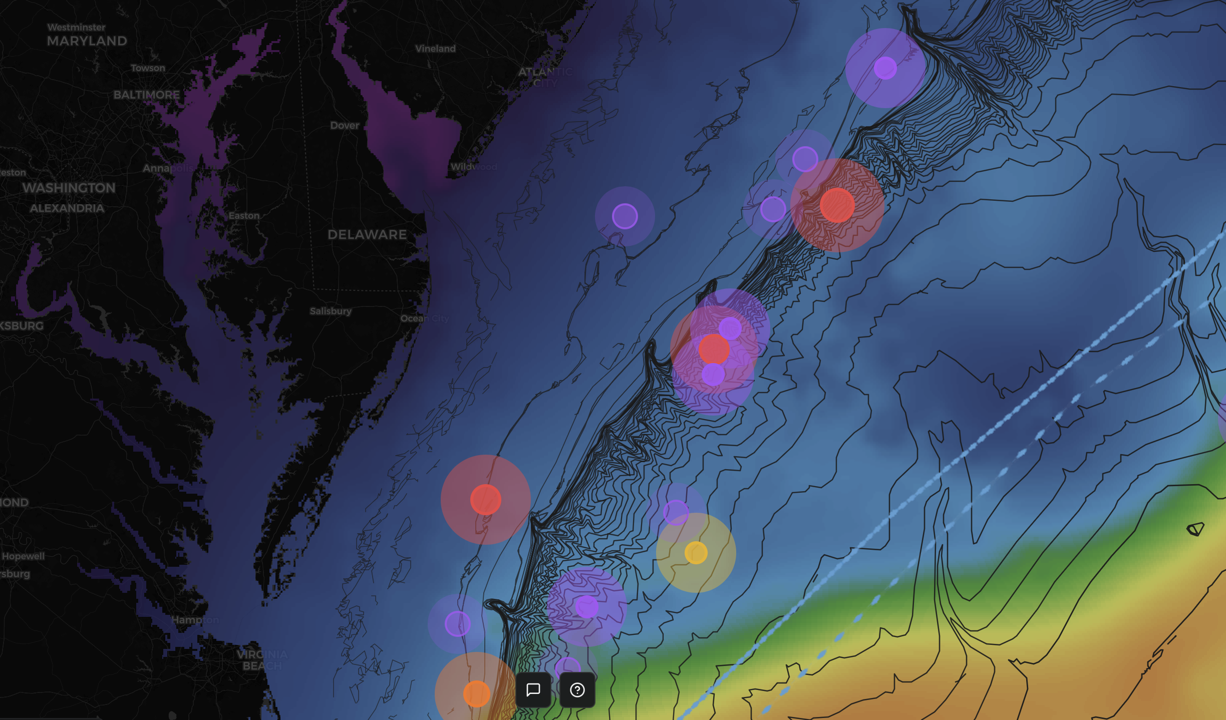
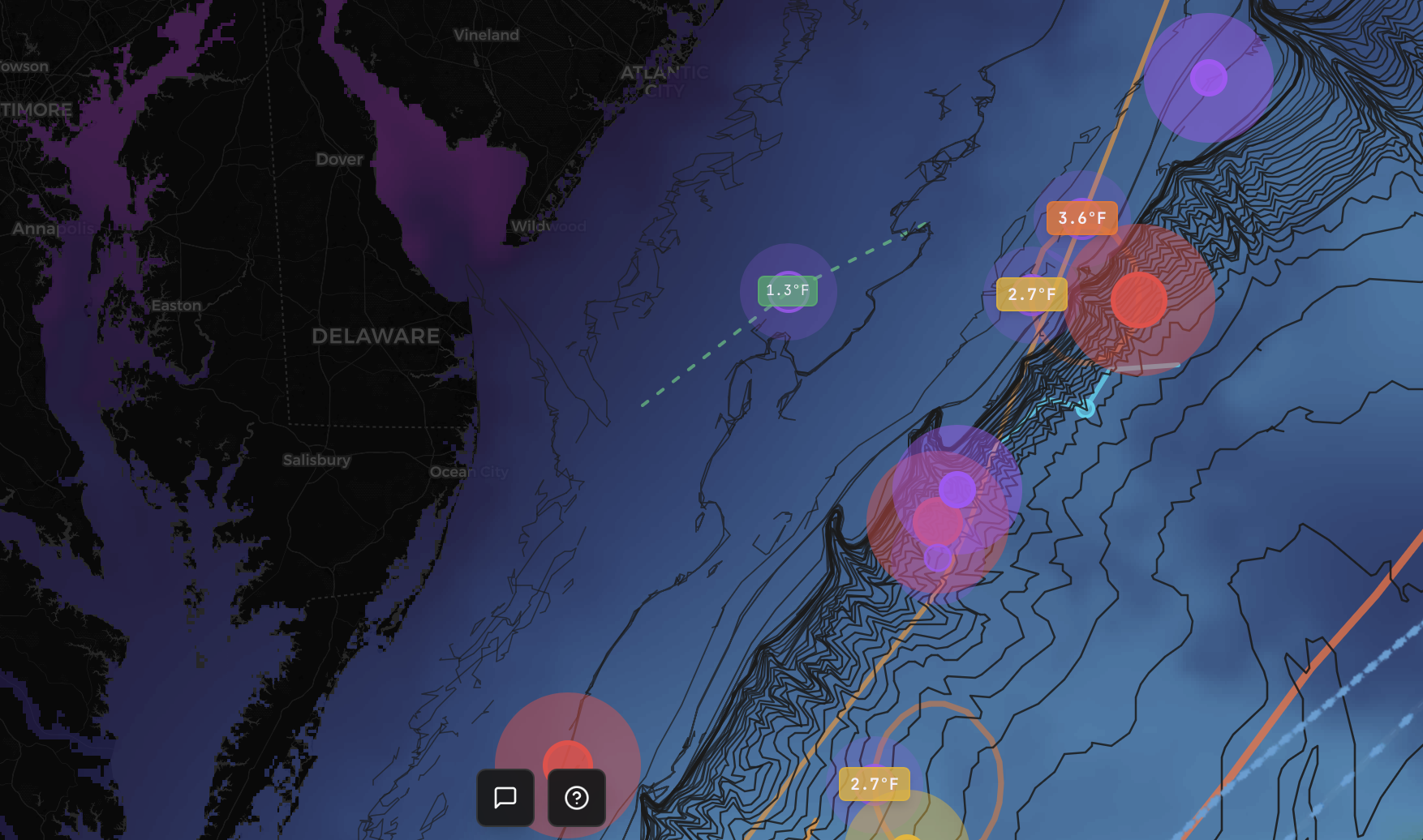
What ABFI Offshore Analyzes
— So You Don’t Have To
Sea Surface Temperature (SST)
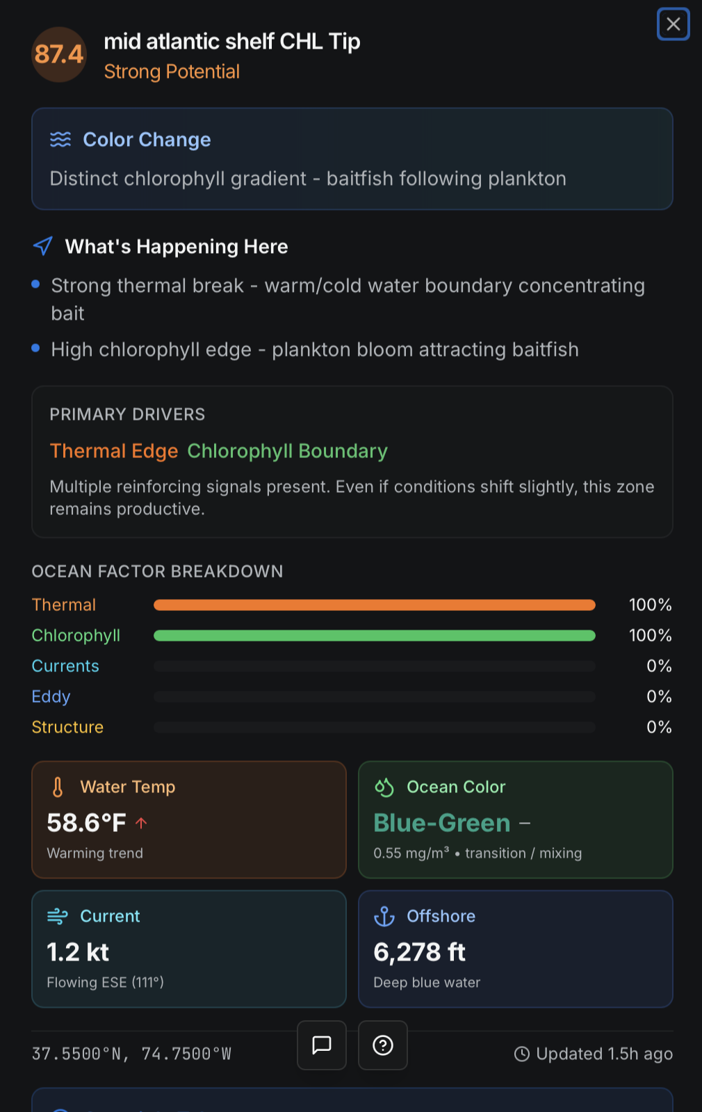
Temperature breaks and edges that concentrate life — the foundation of productive offshore water.
Chlorophyll
Clean vs. dirty water boundaries that define feeding zones — where bait concentrates and predators follow.
Currents & Compression Zones
Where bait and predators stack and hold — the dynamics that turn open water into fishable structure.
Bathymetry & Structure
Canyons, ledges, and depth transitions that anchor conditions — the permanent features that organize offshore water.
Location Intelligence
Coordinates and LORAN formatted for real-world navigation — so you can run to the spot, not search for it.
Built to Explain
Why a Spot Sets Up
The system accounts for cloud cover, data gaps, and signal reliability. It analyzes SST, chlorophyll, depth, structure, and location intelligence together — giving you not just where to go, but why a zone is likely to produce.
That’s the difference between chasing conditions — and understanding them.
Every Advantage.
One Platform.
Intelligence sources, captain networks, and daily deliverables — integrated into actionable offshore guidance.
AI-Powered Intelligence System
The AI ingests real-time SST satellite feeds, chlorophyll concentration data, commercial vessel AIS tracks, member catch reports, and historical pattern databases to identify where water temperature breaks, current boundaries, and bait concentrations converge — pinpointing high-probability zones before you commit to an 80-mile run.
Real-Time Satellite Imagery
Live SST overlays and chlorophyll concentration maps updated continuously from multiple satellite sources.
Commercial Boat Tracking
Track commercial vessel activity to identify productive fishing grounds the pros are working.
Ocean Structure Analysis
Large-scale current systems, thermal boundaries, and compression zones — the macro structure that drives where fish stage and feed.
Captains & Experienced Anglers
A vetted network of Mid-Atlantic captains contributing real-time conditions, bait observations, and tactical intelligence from the water.
Member Catch Reporting
Crowdsourced catch data from the membership feeds back into the AI model, creating an ever-improving intelligence loop.
Daily Offshore Reports
Comprehensive daily briefings covering conditions, recommended zones, species targets, and tactical advice — delivered before you make the run.
SST Data & Imagery
Sea surface temperature maps with annotated breaks, eddies, and thermal edges — the data serious captains rely on.
Temperature Break Alerts
Automated detection and notification of significant thermal boundaries where pelagic species concentrate.
Real reports from members in the field. No editing, no polish — the raw intel that keeps this network honest.
We had a slow pick tunas in south poormans bite turned on in afternoon when we left then ran into acres of bluefins on top water on the way in around the hot dog. Goin back out sat!
Designed for
Offshore Anglers
ABFI Offshore is built by offshore anglers, for offshore anglers. The system is designed around the decisions you actually make — not abstract data for its own sake.
Because offshore fishing rewards preparation and understanding.